Hiking around the Lysefjord using Flørli as a steppingstone or your basecamp.
Dayhike to Preikestolen (Pulpit Rock)

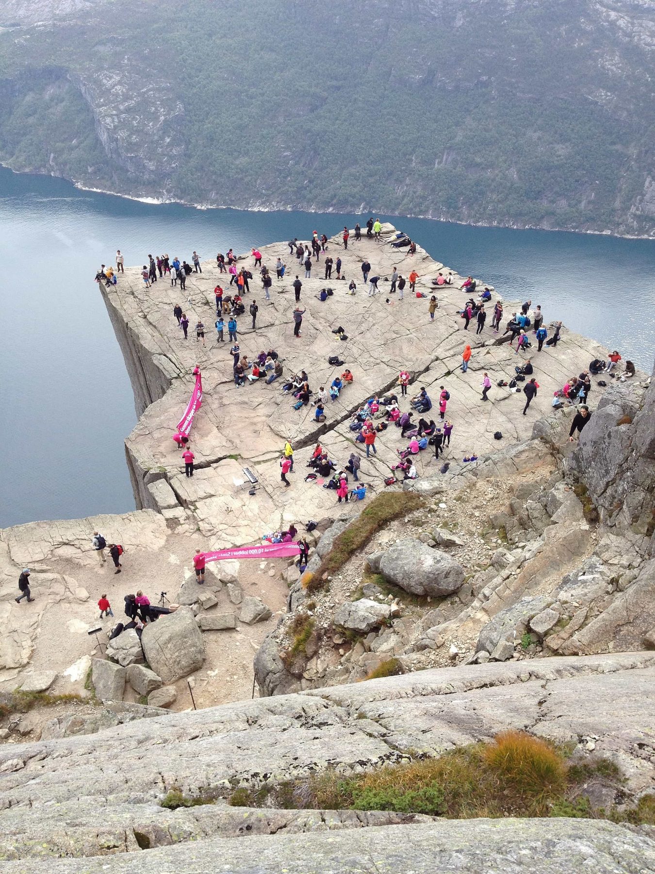
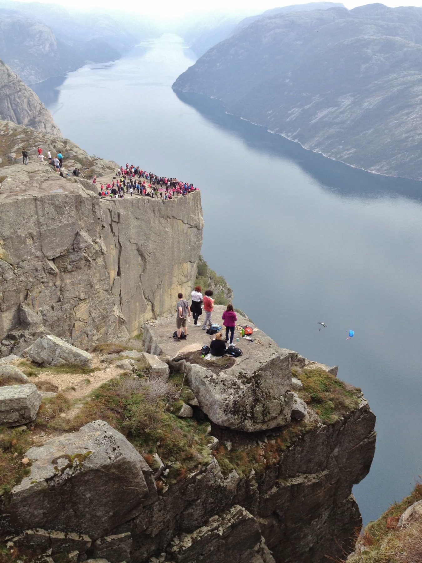
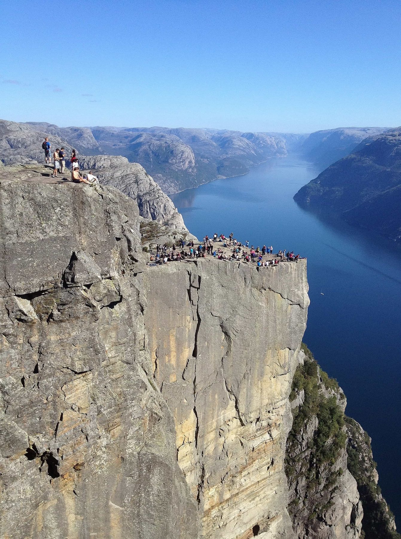
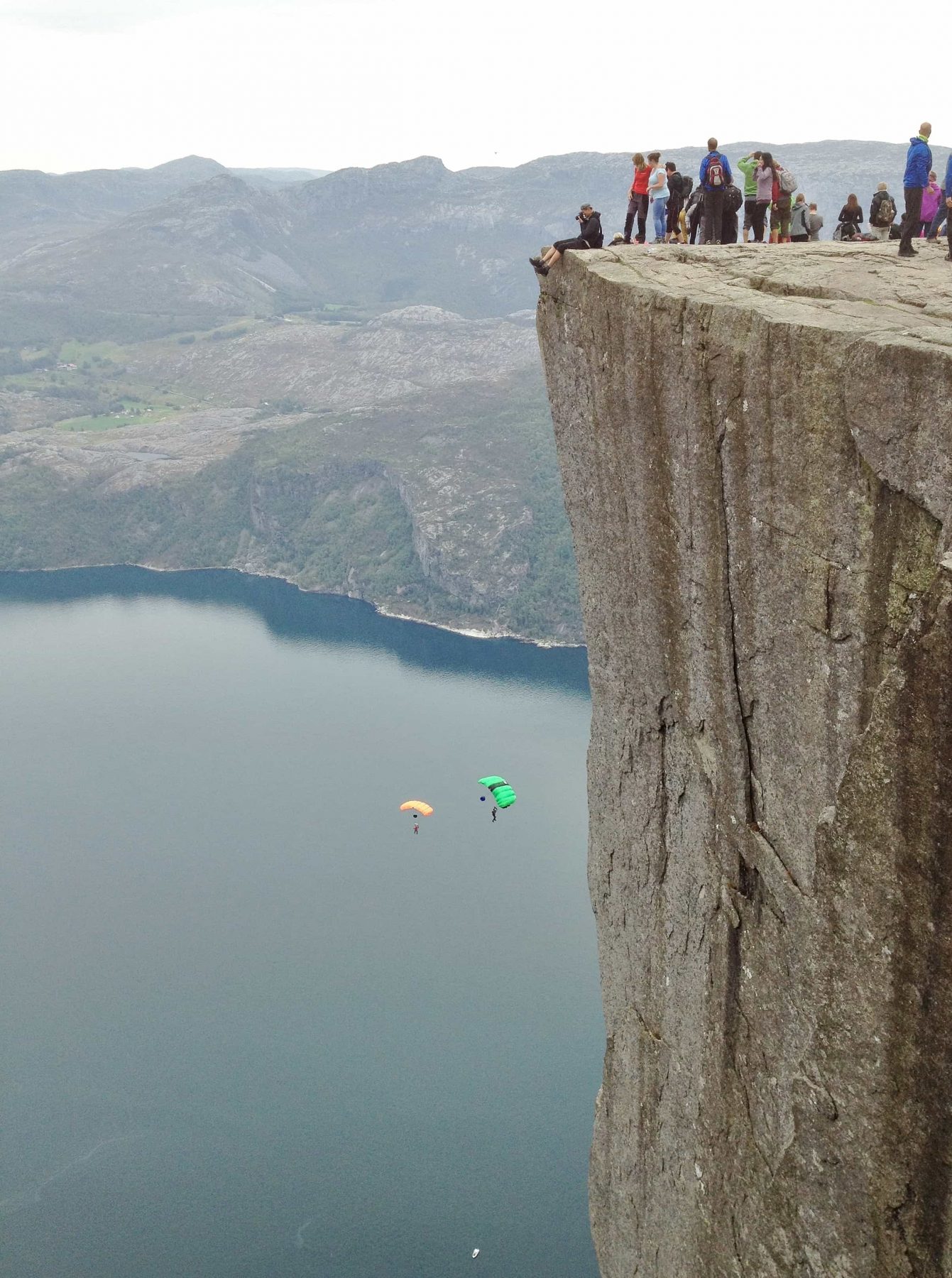
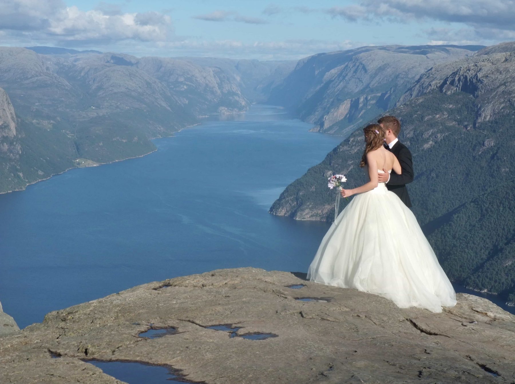
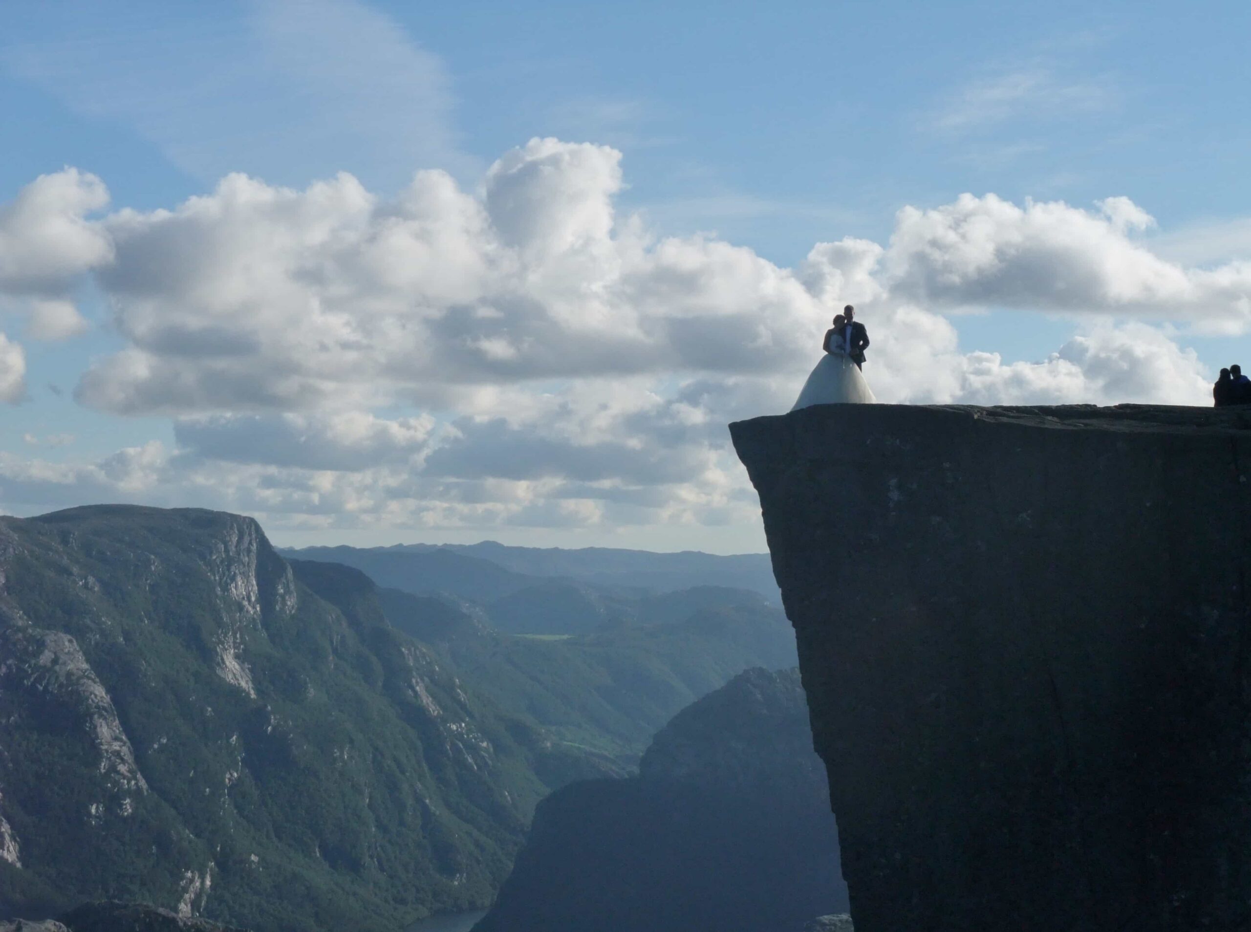
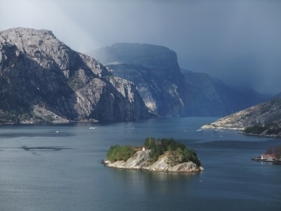
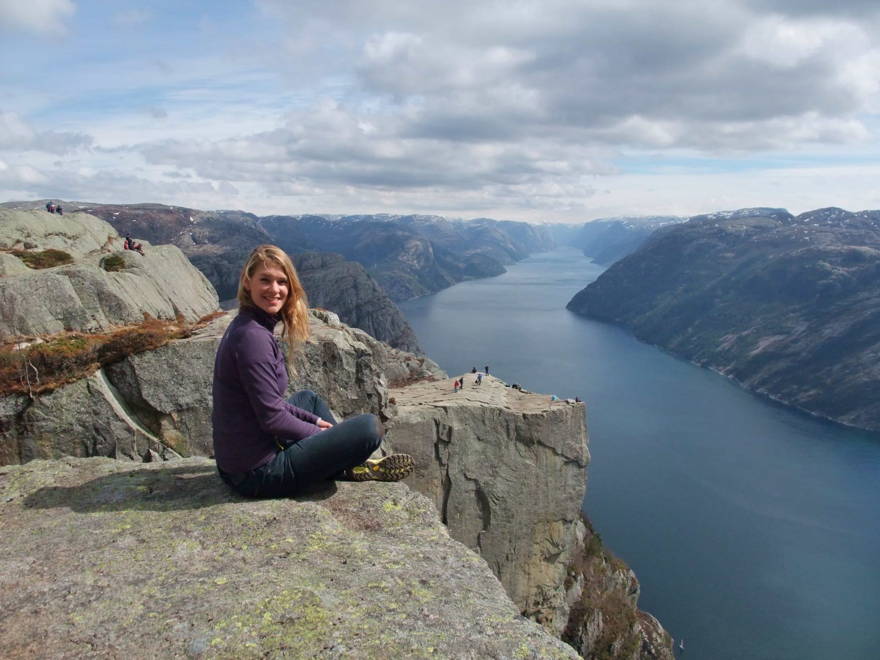
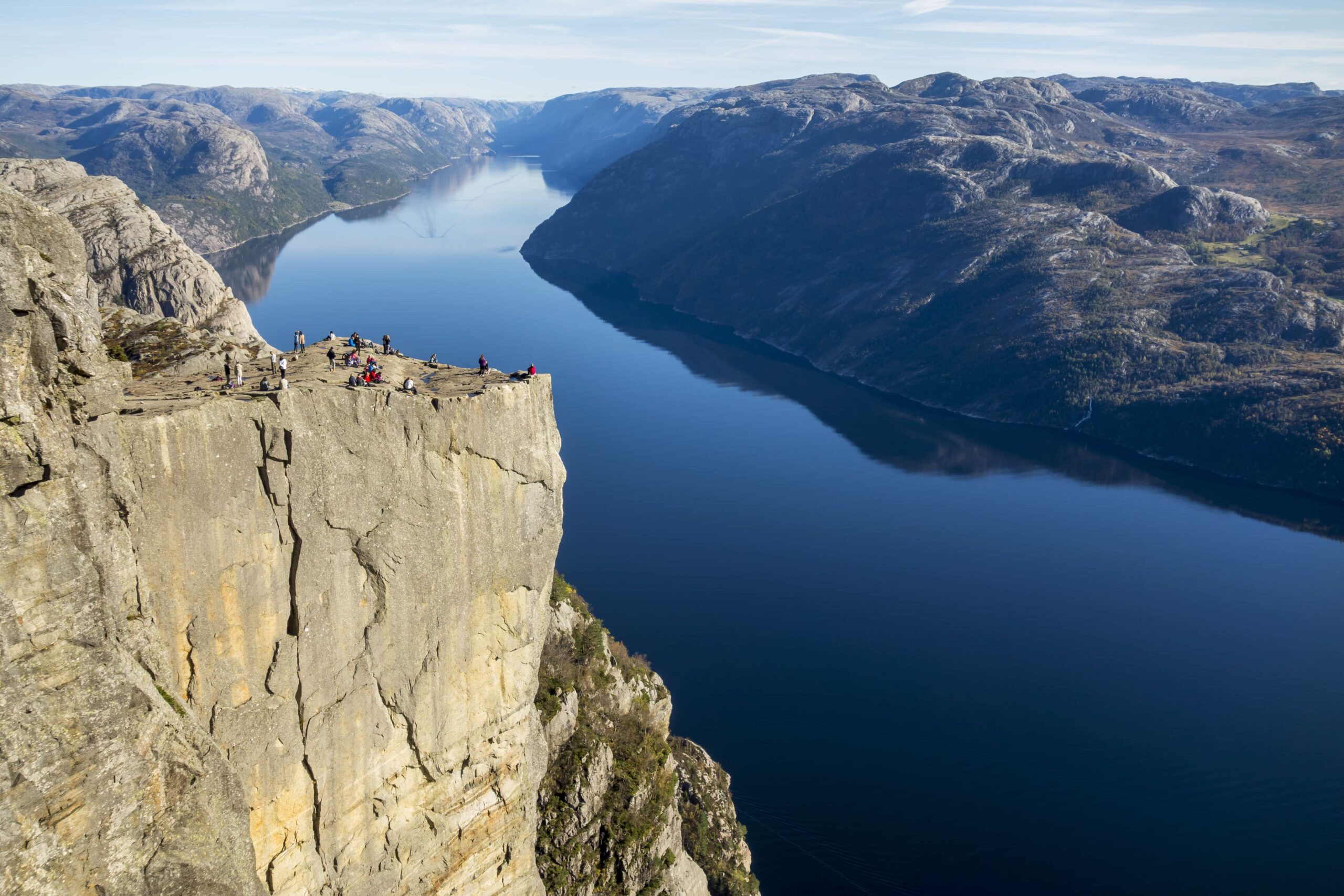
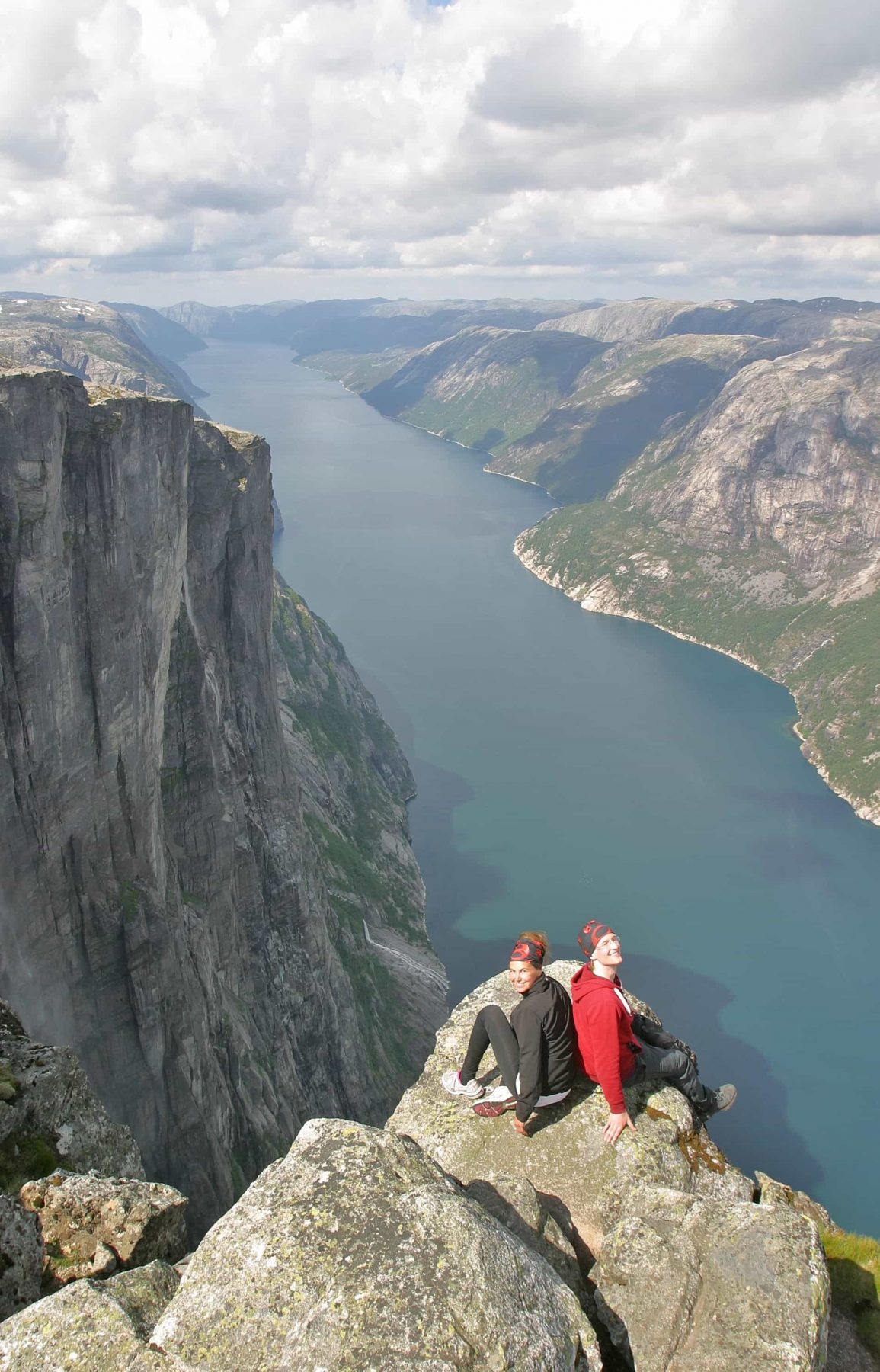
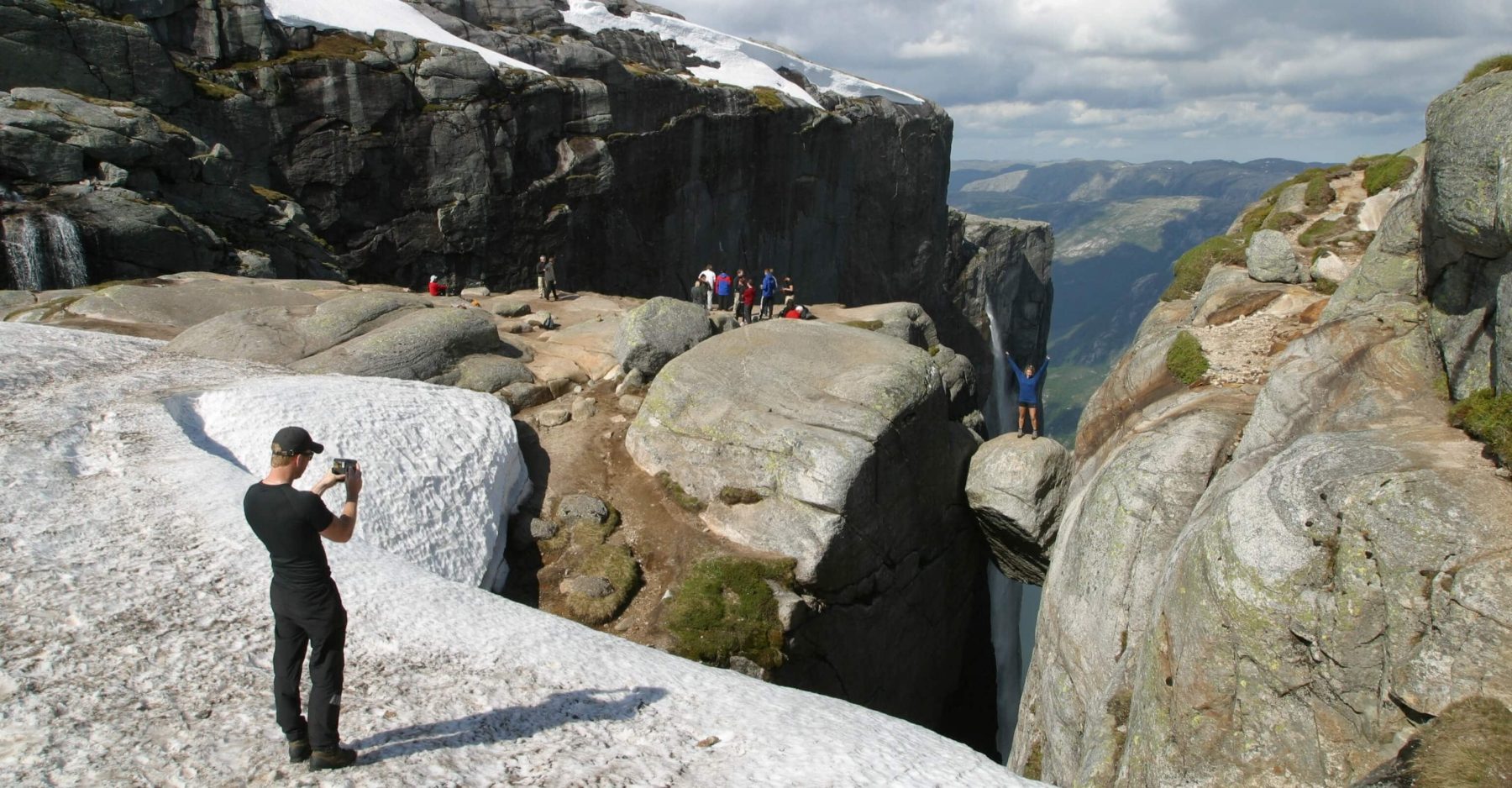
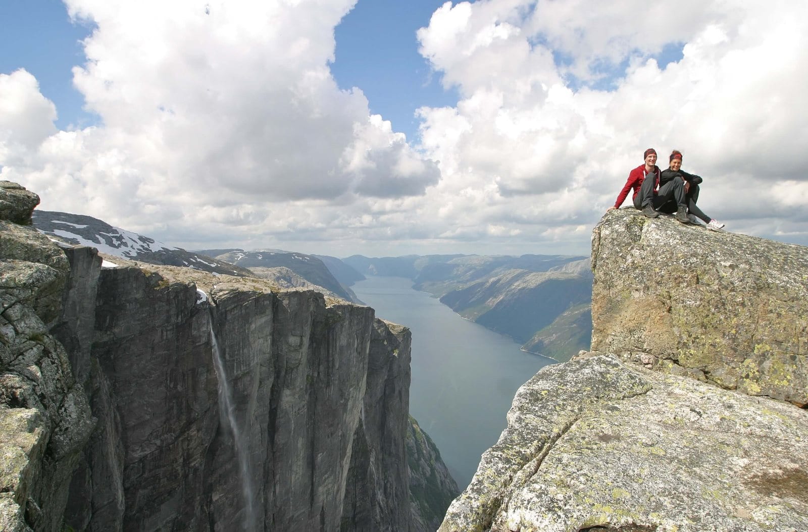
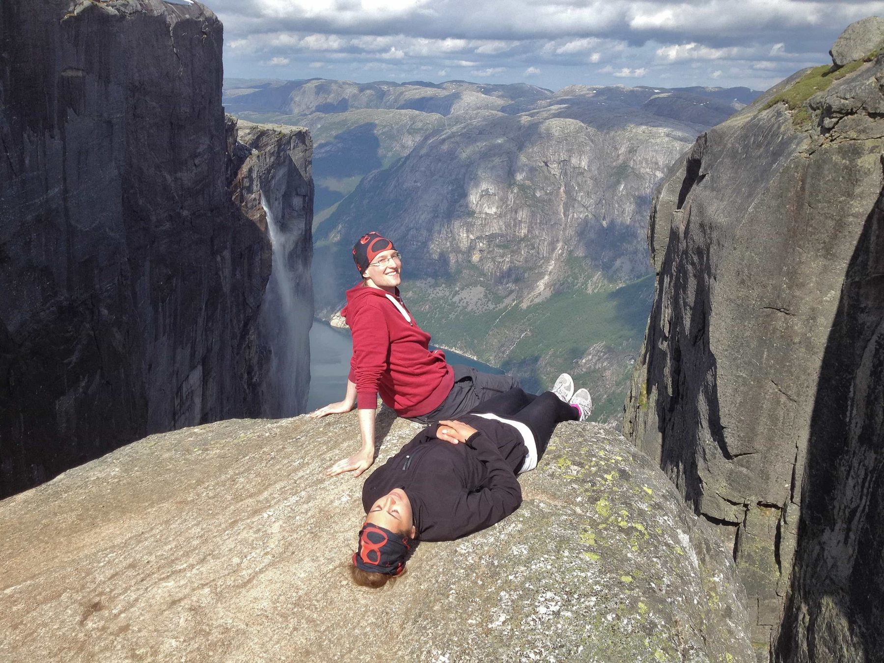
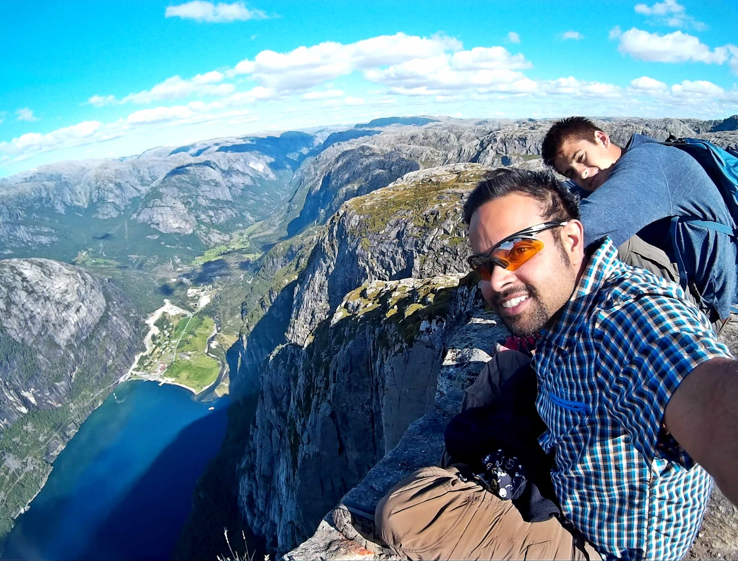
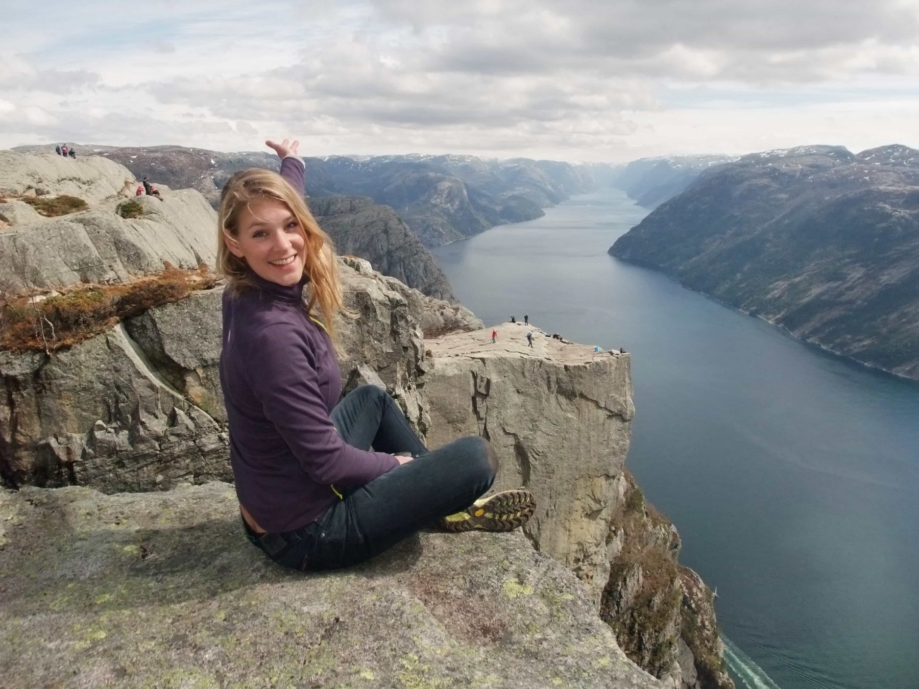 With over 300.000 visitors each summer, the Preikestolen is the most visited mountain of Norway and it lies just across the fjord from Flørli. Standing on top, you will have the entire Lysefjord at your feet and can look over to the village.
Preikestolen can be visited before or after your Flørli stay. As a daytrip from Flørli, you can visit Preikestolen on weekdays only due to ferry schedules, and friday is best. Read more about Preikestolen here.
A friday visit to Preikestolen looks like this: take the early Kolumbus ferry to Forsand, then book the shuttlebus Pellesreiser or use your own car to take you to the Preikestolen trailhead. Hike 2 + 2 hours. The last Kolumbus ferry to Flørli leaves from Forsand at 14:00 (fridays at 17:00). You can also catch the more expensive Rødne ferry back to Flørli, which leaves every day at 15:20. Read more about ferries on the Lysefjord.
-
- Preikestolen
-
- Preikestolen
-
- Preikestolen
-
- Preikestolen
-
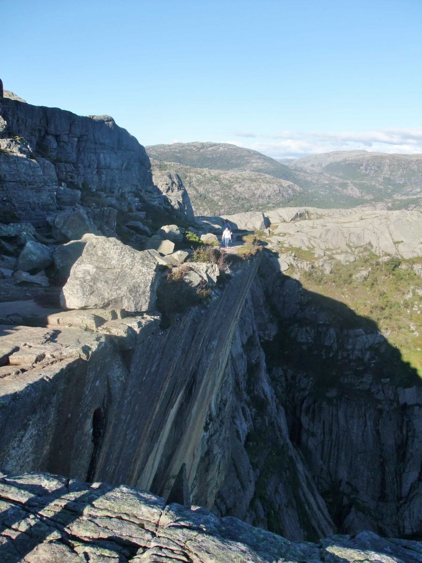
- Path to Preikestolen
-
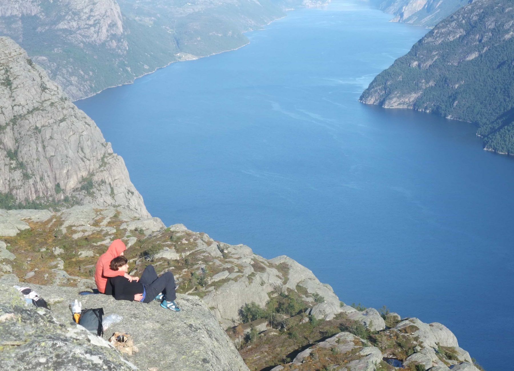
- View from Preikestolen
-
- Preikestolen
-
- Preikestolen
-
- Preikestolen
-
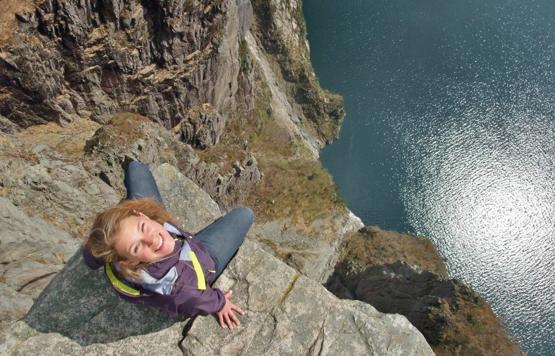
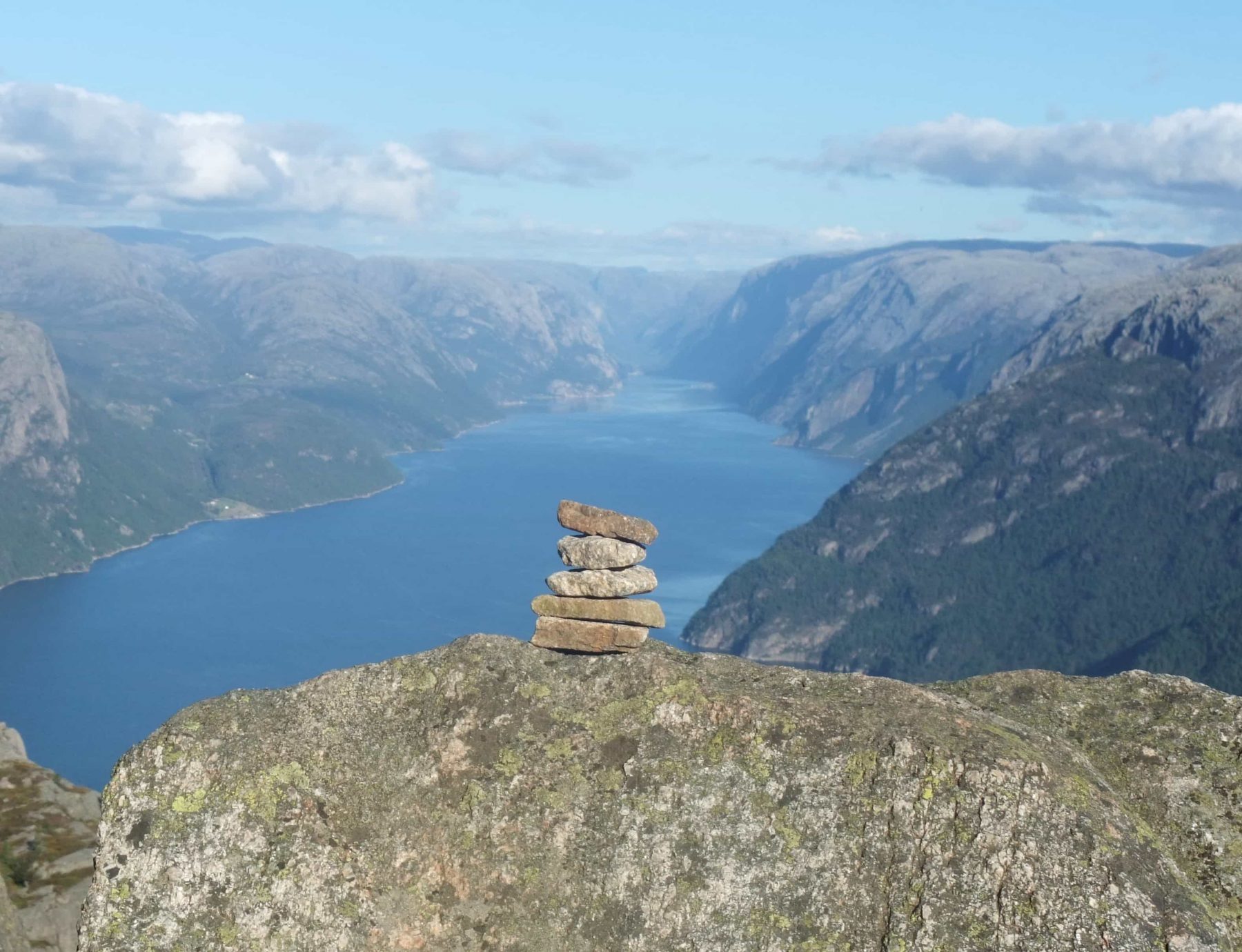
- Preikestolen look straight down
Dayhike to Kjerag (Kjeragbolten)
![]()
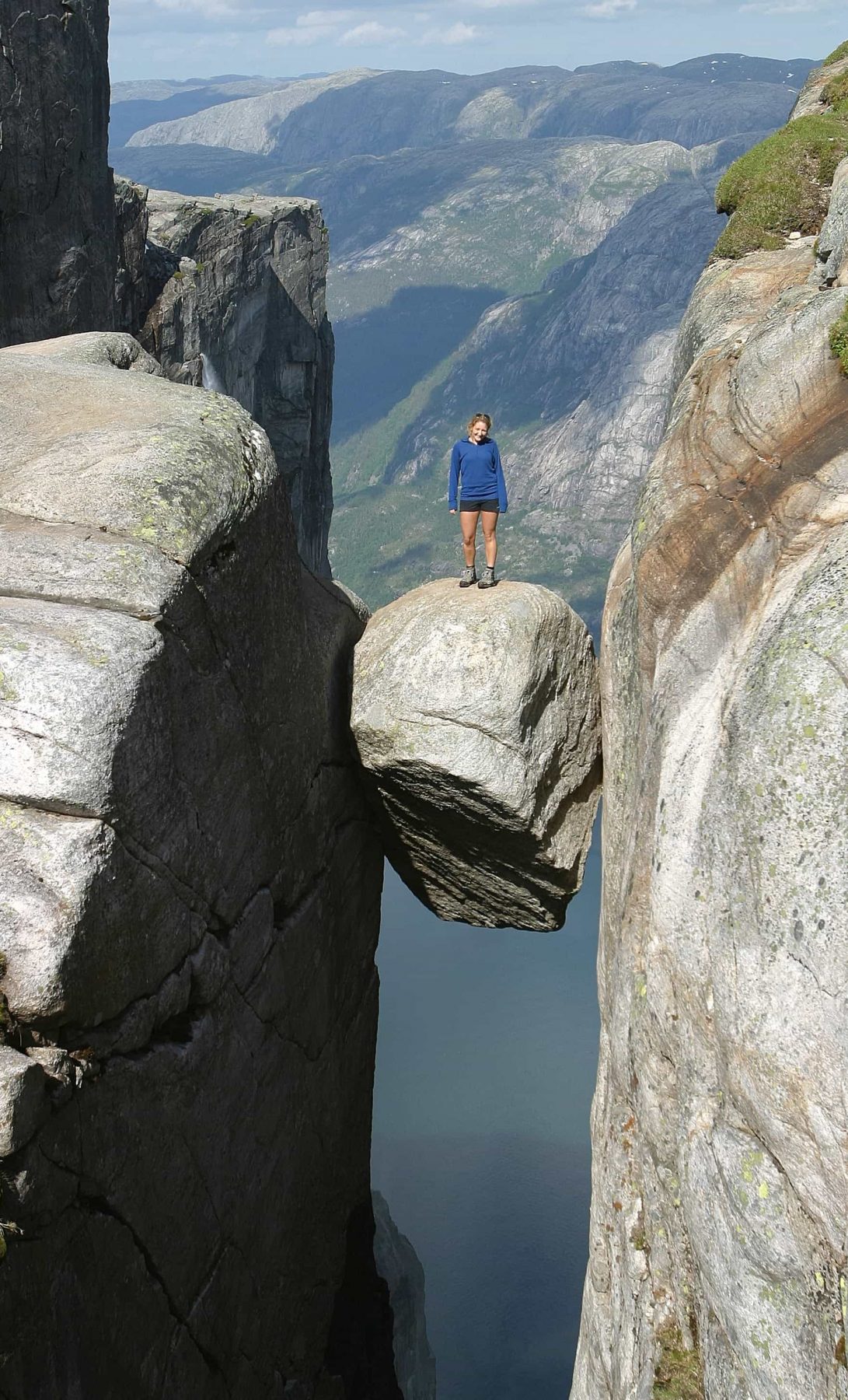
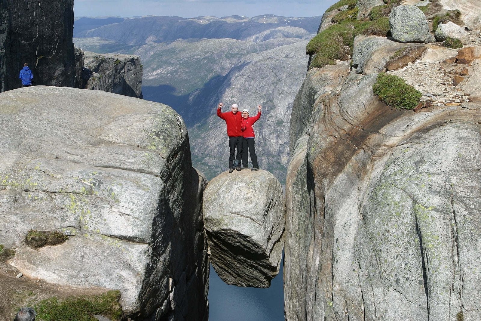
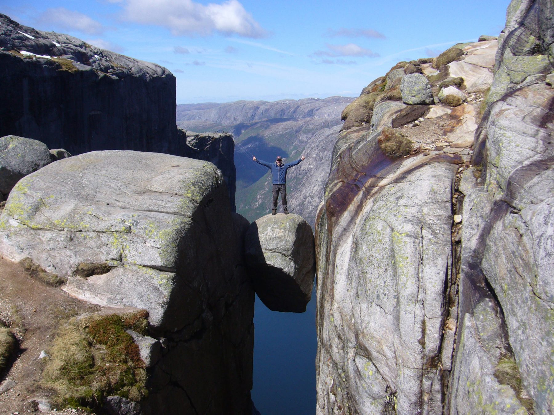
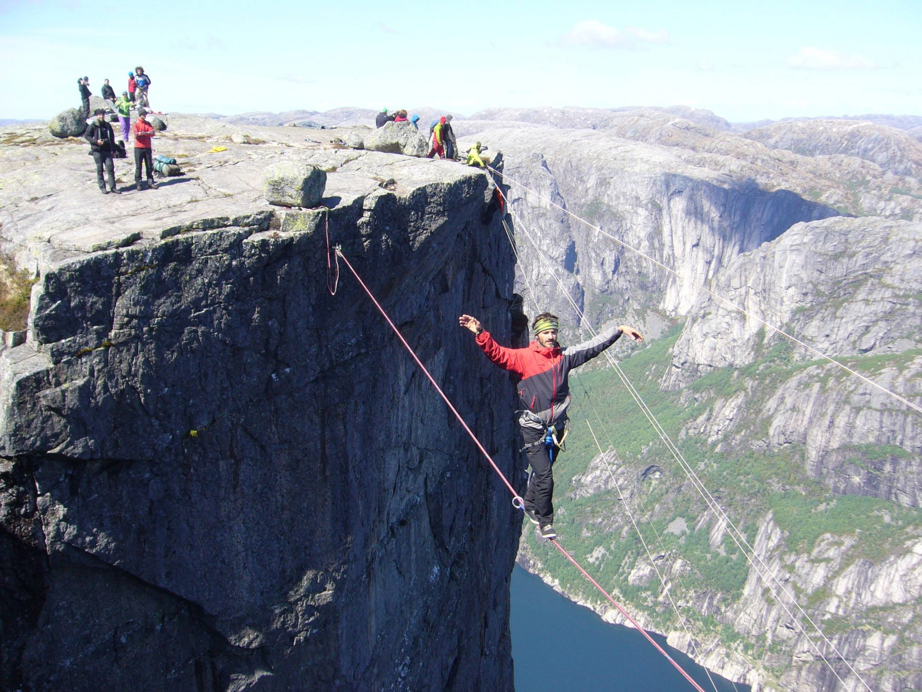
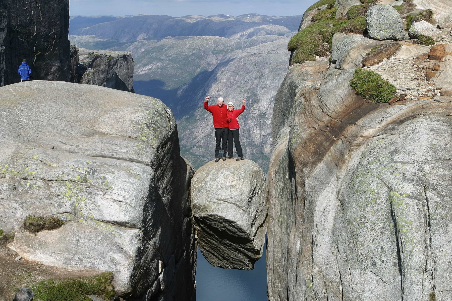
 Possible on all days except saturday due to ferry schedules. With over 100.000 visitors each year, the Kjerag and Kjeragbolten are the other prime sights of the region. You will enjoy seeing the basejumpers “exit”, hanging your head over the 1000 metres vertical wall or pose on the boulder wedged above the abyss. More info here.
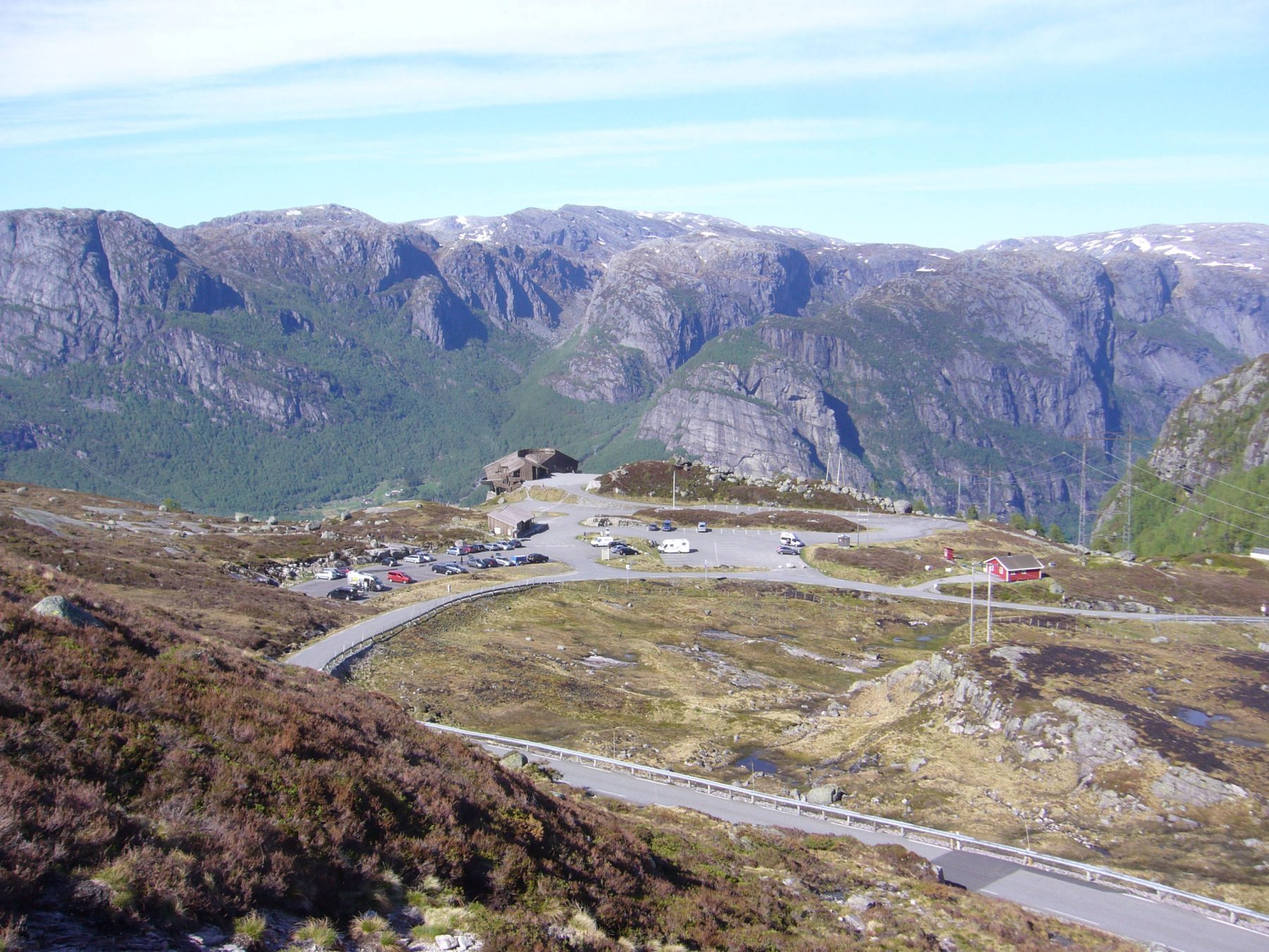
Take the early Kolumbus ferry to Lysebotn, arrival at 07:10 (also 09:10 on mo, we, su). Take the shuttle bus or car to the trailhead at Øygardstøl. Hike 5 hours (3+2) roundtrip. Take the shuttle bus or car down. The Kolumbus ferry departs back to Flørli at 15:15 (also 15:55 on mo, we, su).
Getting from Lysebotn ferry quay to Øygardstøl (Kjerag parking) without a car: Stavanger Baseklubb SBK offers a shuttle-service in june, july and august, 250kr pp each way (2026). Taxi transportation is also offered by Kjerag-Lysebotn Camping & Resort at 250kr pp each way (2026).
-
- Kjerag
-
- Kjeragbolten
-
- Path to Kjerag
-
- Kjerag
Dayhike Kjerag to Flørli
![]()
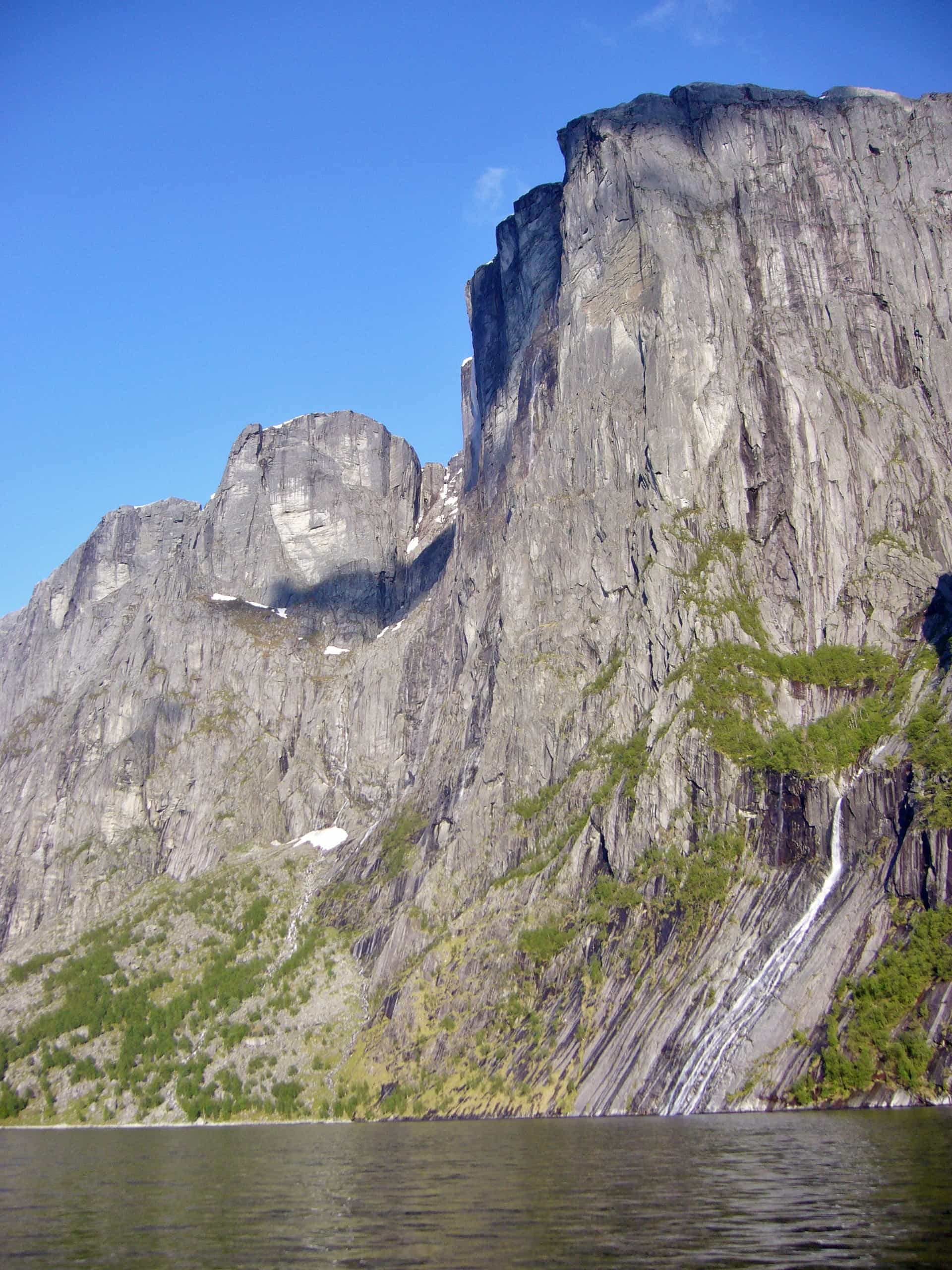
 Yes, it is possible to hike directly to Flørli via Kjerag. Starting point for the hike is the Kjerag parking at Øygardstøl. You’ll spend a long day in awesome highland terrain, it’s suited for very fit people only. The trip starts with the regular hike to Kjerag, then continues past Kjerag across undulating treeless highlands, through grazy valleys amidst rocky outcrops, to the top of the Flørli Stairs. Map and info here.
The other way around, starting with the Flørli Stairs and on to Kjerag is too demanding for a day tour. In that case, you’ll need your own tent or hike on to Langavatn cabin of the Stavanger Trekking Association STF. Flørli to Langavatn: 16km, 8hrs. Langavatn to Kjerag and on to Øygardstøl: 11km, 5hrs.
2-day Preikestolen to Flørli
![]()
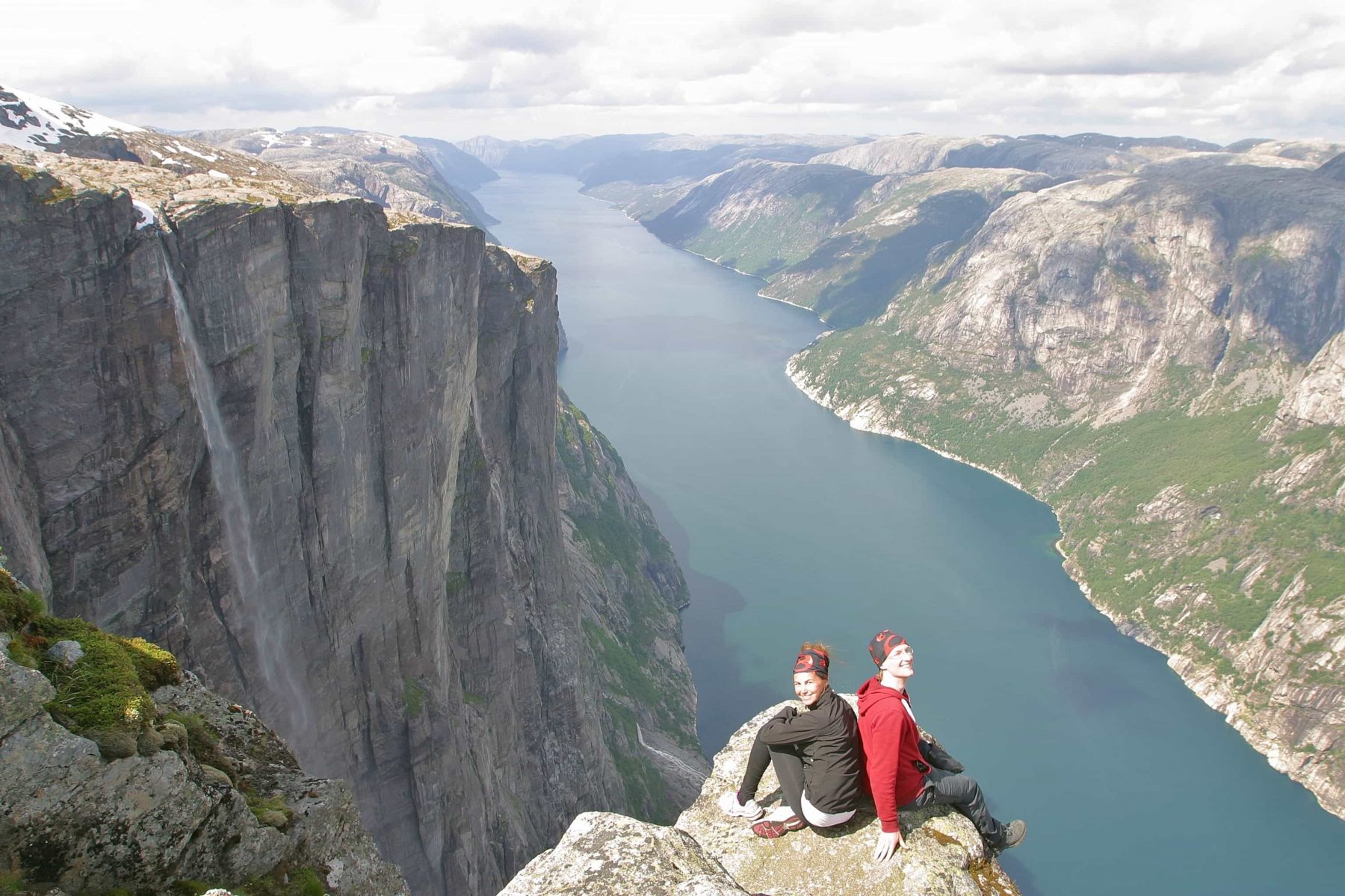
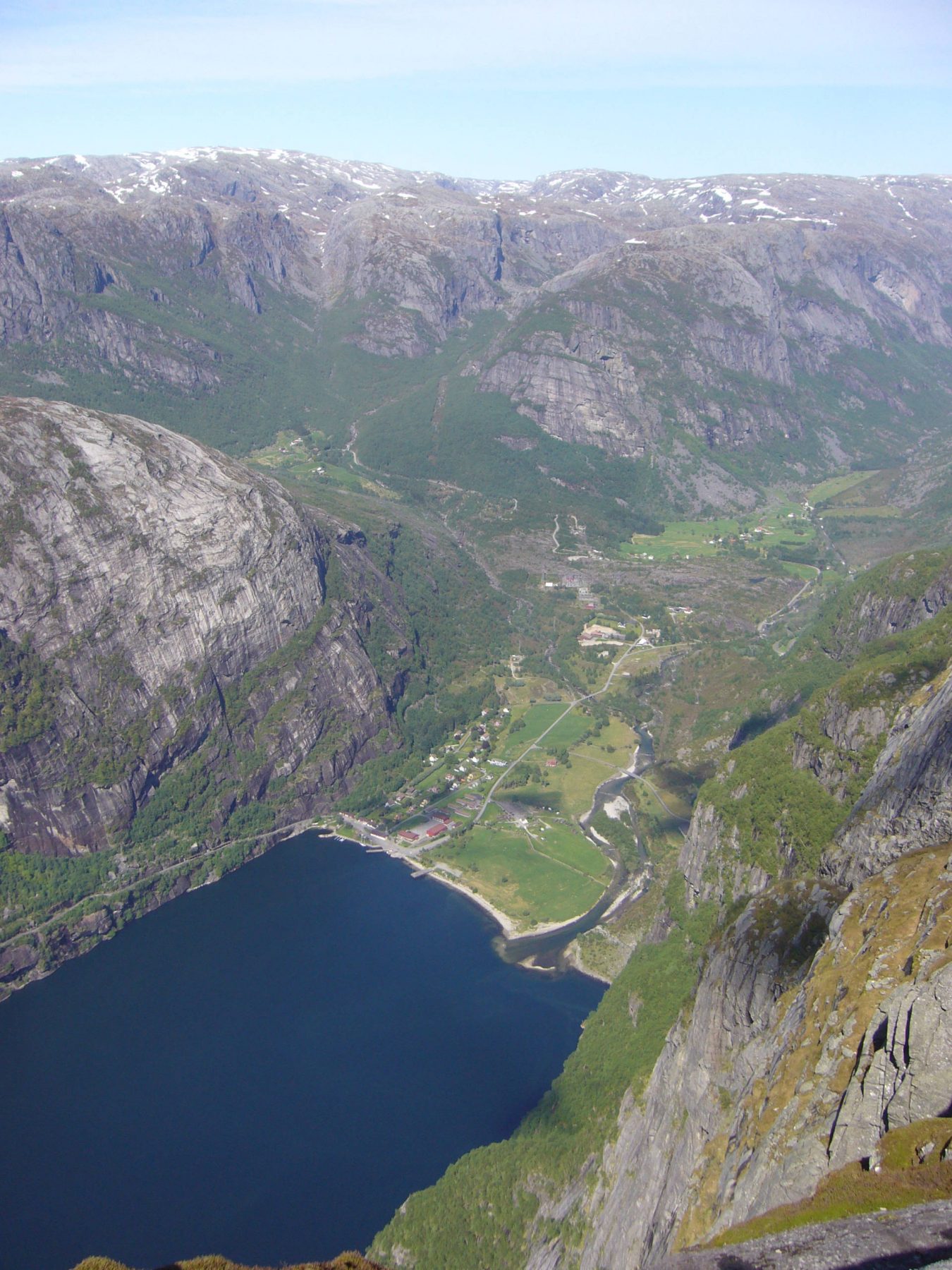
 Hike the scenic northern rim of the Lysefjord! One long day or two days with tent. A popular hike and for good reason. Visit Preikestolen and Hengjandenibbå (the mini-Preikestolen). This is a long hike in demanding terrain. Bring a tent and see it all or skip the Preikestolen detour and head straight for Bratteli quay, 7hrs. Hiking map here. Leave early and make sure you are at Bratteli around 14:10 to catch the Kolumbus ferry to Flørli. You need to prebook this ferry!
You can also hike on to Bakken, the cabin of the Stavanger Trekking Association (STF), just an hour further from Bratteli. There is a ferry quay there as well from where you can go to Flørli the next day. If you’re in need of a taxi boat to take you to Flørli, we have some local contacts that could help you out, send us a message.
Dayhike or 2-day Vinddalen via Skåpet to Flørli
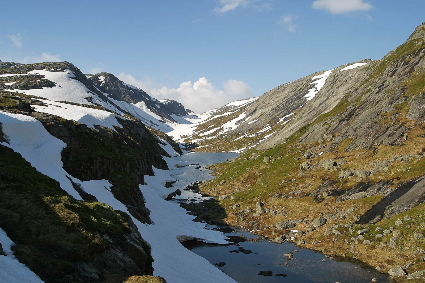
![]() Popular 5 hour hike that takes you from the parking in Vinddalen via Skåpet and all the way down to Flørli: 12km, 5hrs. Map and info here. From Vinddalen, the path follows a river, then the valley opens up at Skåpet where you see the new modern mountain lodge of the Stavanger Trekking Association (STF) in its picturesque setting (see picture). Many choose to stay overnight here, but you can do the itinerary as a dayhike. As you continue past Skåpet, the path enters the barren highlands with grazy valleys and rocky hills. The descent to Flørli is boggy, but you are rewarded with wide scenic panorama’s. You can ask Pelles Reiser to put you off in Vinddalen.
Popular 5 hour hike that takes you from the parking in Vinddalen via Skåpet and all the way down to Flørli: 12km, 5hrs. Map and info here. From Vinddalen, the path follows a river, then the valley opens up at Skåpet where you see the new modern mountain lodge of the Stavanger Trekking Association (STF) in its picturesque setting (see picture). Many choose to stay overnight here, but you can do the itinerary as a dayhike. As you continue past Skåpet, the path enters the barren highlands with grazy valleys and rocky hills. The descent to Flørli is boggy, but you are rewarded with wide scenic panorama’s. You can ask Pelles Reiser to put you off in Vinddalen.
Preikestolen: start hiking before 9:30 am and beat the crowds. Hike up swiftly, so that you can have a long break at the summit and make it back in time for the ferry.
Pelles Reiser offers an excellent taxi service from Forsand quay to the parking at Preikestolen. Parking fee for cars at Preikestolen 275kr (2026).
The Preikestolen hike can be done much of the year, also in winter. Crampons for hiking on snow and ice are rented out by the mountain lodge Preikestolen Fjellstue. Free toilet at the parking
Kjerag: psychologically demanding hike, up a steep crest with chains to hold on to and two valleys to cross on the way. Possible to miss the path and get lost on the top of the mountain under foggy conditions. Highland terrain: sudden rain, fog and fierce winds are common.
The parking fee at Kjerag is 300kr (2026). There is no shop or fuel station close to Kjerag or in Lysebotn, restaurants yes!
Kjerag is closed due to snow in winter, from about middle of october to around the 17th may. Free toilet at the parking. Hitch-hikers can quite easily get a lift between Kjerag parking and Lysebotn ferry quay.
Around the Lysefjord: you can hike around the Lysefjord in multiday hikes. Very worthwhile! Bring a well-fitted backpack, waterproof hiking shoes and warm, wind-blocking clothes.
Average hiking speed may be as little as 2km per hour due to the demanding nature of the terrain! You need a topographic map 1:50.000, can be bought in the Flørli café.
Book ferries in advance, mobile coverage varies and ferries may not stop if you haven’t booked.
Guided hikes are offered by Fjordhikes, Lysefjorden Adventure and Trolladventure
The hike from Flørli to Kjerag is too demanding for most! You need to cut it up by spending a night in Langavatn Turisthytte or bringing a tent and camping up there.
Hiking from the Kjerag parking (Øygardstøl), via Kjerag and then on to Flørli is possible for fit hikers with limited gear – it will be a long day!

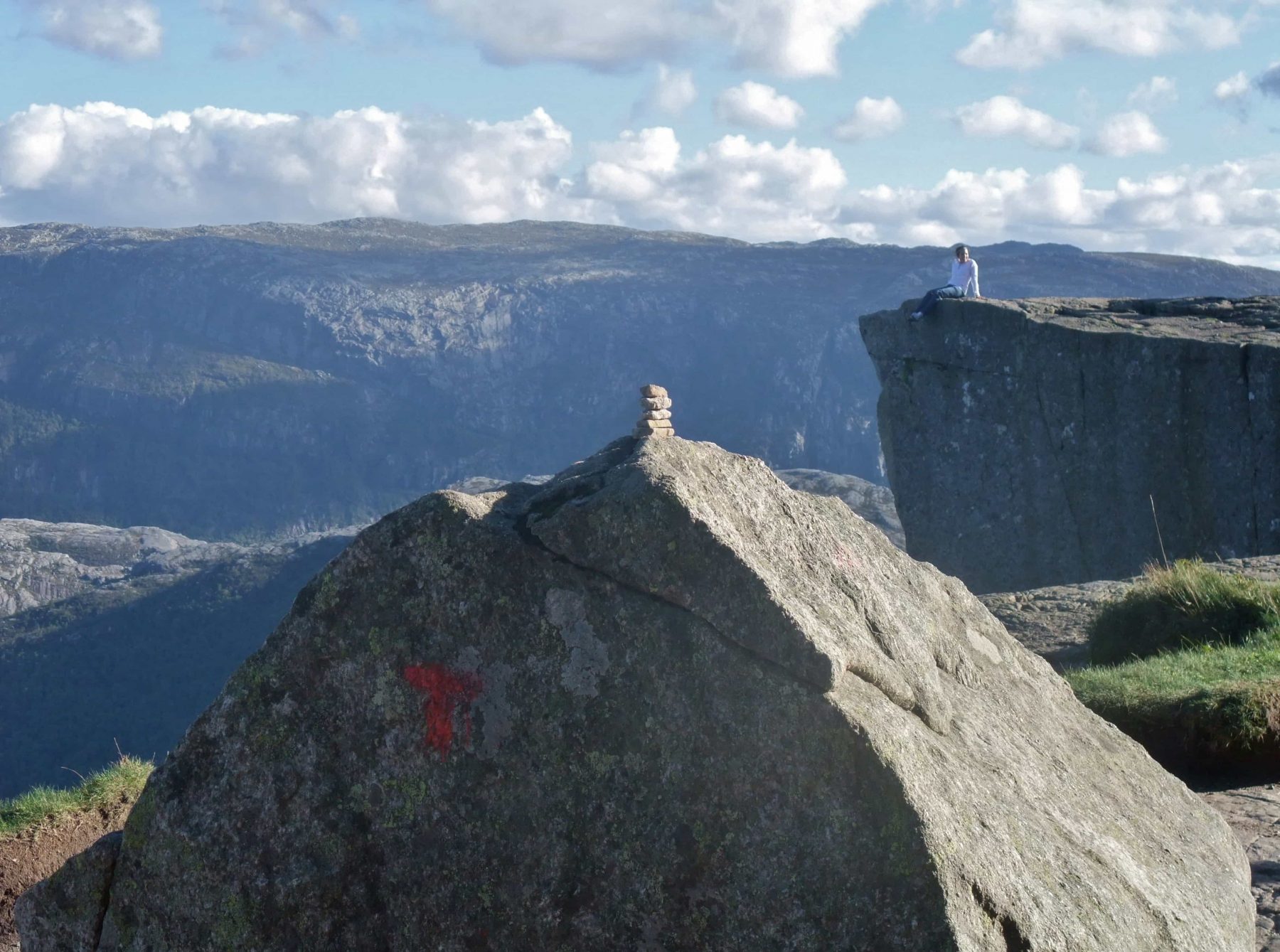
Note that hiking paths in Norway are generally rocky or boggy and uneven. They are marked with cairns and red T’s. You need to be fit to undertake ambitious hikes around the fjord!